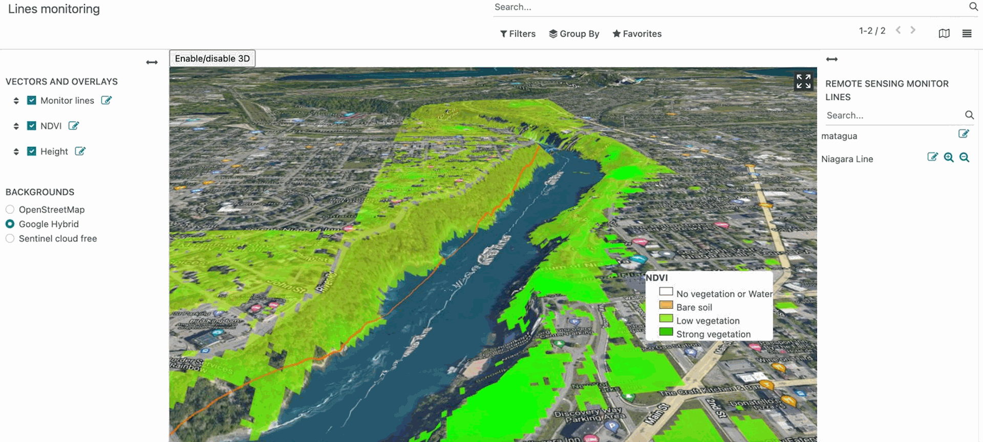
Odoo geo-model visualization in 3D
3D geospatial data visualization is a powerful tool that enables the representation of entity information in three-dimensional scenes. This technology has generated significant interest within the geospatial community due to its considerable advantages. 3D visualization extends beyond mere map representation; it facilitates the creation of three-dimensional models of buildings, landscapes, cities, and other real-world elements. The capability to visualize data within its three-dimensional context offers a more profound and comprehensive understanding of geospatial information. 3D visualization has become essential for various applications, including vehicle tracking, agricultural analysis, and generating maps from soil data.
Volttus has developed 3D visualization of Odoo geospatial models using Cesium Ion as the foundational platform. Cesium Ion provides access to curated global 3D content, including Cesium World Terrain, Bing Maps imagery, and Cesium OSM Buildings. With our widget, you can merge these assets with your data to visualize it in a geospatial context, and securely share the results with your colleagues or make them available through your apps.
Odoo Web Map Service
The company incorporates the use of standards such as "Web Map Service" (WMS) in Odoo, which allows it to enter the group of Spatial Data Infrastructure (SDI) technologies, which allows the management, access, use and exchange of geospatial data in a manner coordinated and efficient. In this way it allows users to discover, access and share spatial data from different sources, and use it to make informed decisions in different contexts.
OGC Web Map Service Interface
A WMS (Web Map Service) is a type of web service that follows the Open Geospatial Consortium (OGC) standards for online map publishing. A WMS service allows users to request georeferenced maps online through a web interface.
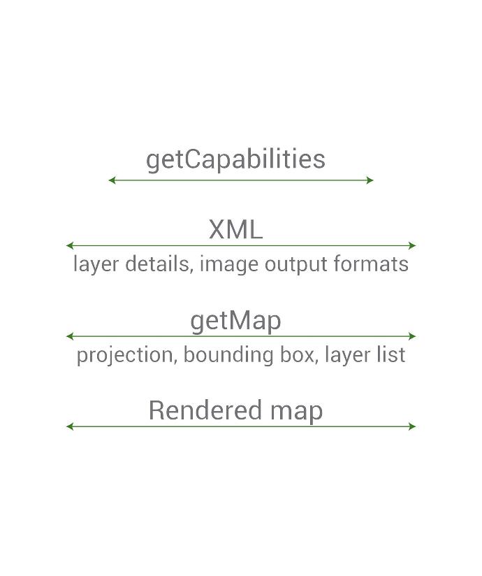
In a WMS service, the map server provides georeferenced map images in response to client requests, which can be displayed in a map viewing application. These map images are dynamically generated from geospatial data stored on the server. A basic map service has three interfaces:
- GetCapabilities: Provides information about the capabilities of the Service, the version of the interface and the list of layers that can be used, as well as their styles, spatial reference systems and geographical limits.
- GetMap: Allows you to generate a map of a region of space defined by its limits and the geographic projection that defines it, the list of information layers that will be added to the map with their styles, the dimensions and the format of the image that will be generated.
GetFeatureInfo: Allows you to obtain information about any point in an image generated with a request to the GetMap interface. As parameters, it uses the same ones from the GetMap request plus the pixel coordinates of the point of interest, the layer to be surveyed and the information output format.
World Wide adopted standard
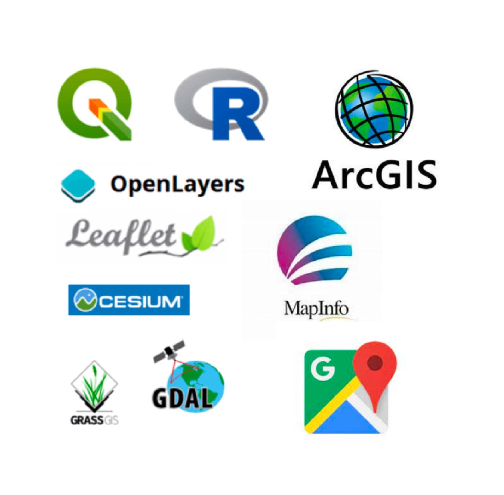
As it is a well-disseminated standard and accepted by the geographic community, there are many clients that allow the visualization of published maps using this interface. From Web application development frameworks such as OpenLayers and Leaflet to established desktop applications such as Qgis, GvSIG and others, there are ways to interoperate with these services.
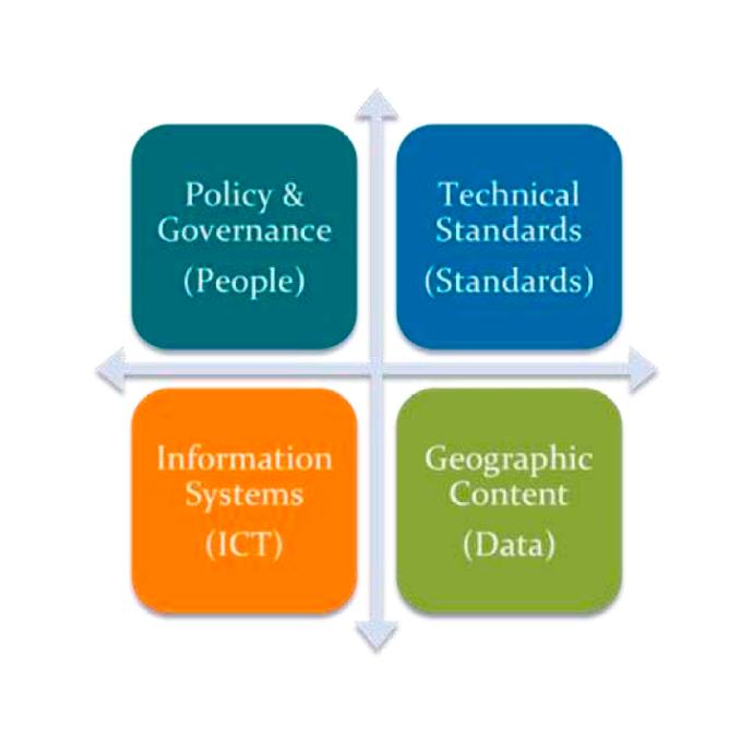
Spatial Data Infrastructure
In an SDI, different components are combined to create a platform that allows the management of spatial data. These components may include geographic information systems (GIS), web mapping services (WMS), geocoding services, geospatial data discovery services, among others. There are several tools that allow publishing information available in geospatial files or in Databases such as Geoserver, Mapserver and others as WMS.
The advantages of this integration between an Enterprise resource planning (ERP) in an IDE environment would be the sum of the advantages of using both technologies, among them:
- Improved decision making: By making spatial information available alongside business data, decision makers can gain a more complete understanding of the situation and make better-informed decisions.
- Improved collaboration: By sharing spatial information between different departments and organizations, SDIs can facilitate collaboration and improve coordination.
- Increased efficiency: By automating the process of sharing spatial information, SDIs can help improve efficiency and reduce costs.
- Greater transparency: By making spatial information available to the public, SDIs can help improve transparency and accountability.
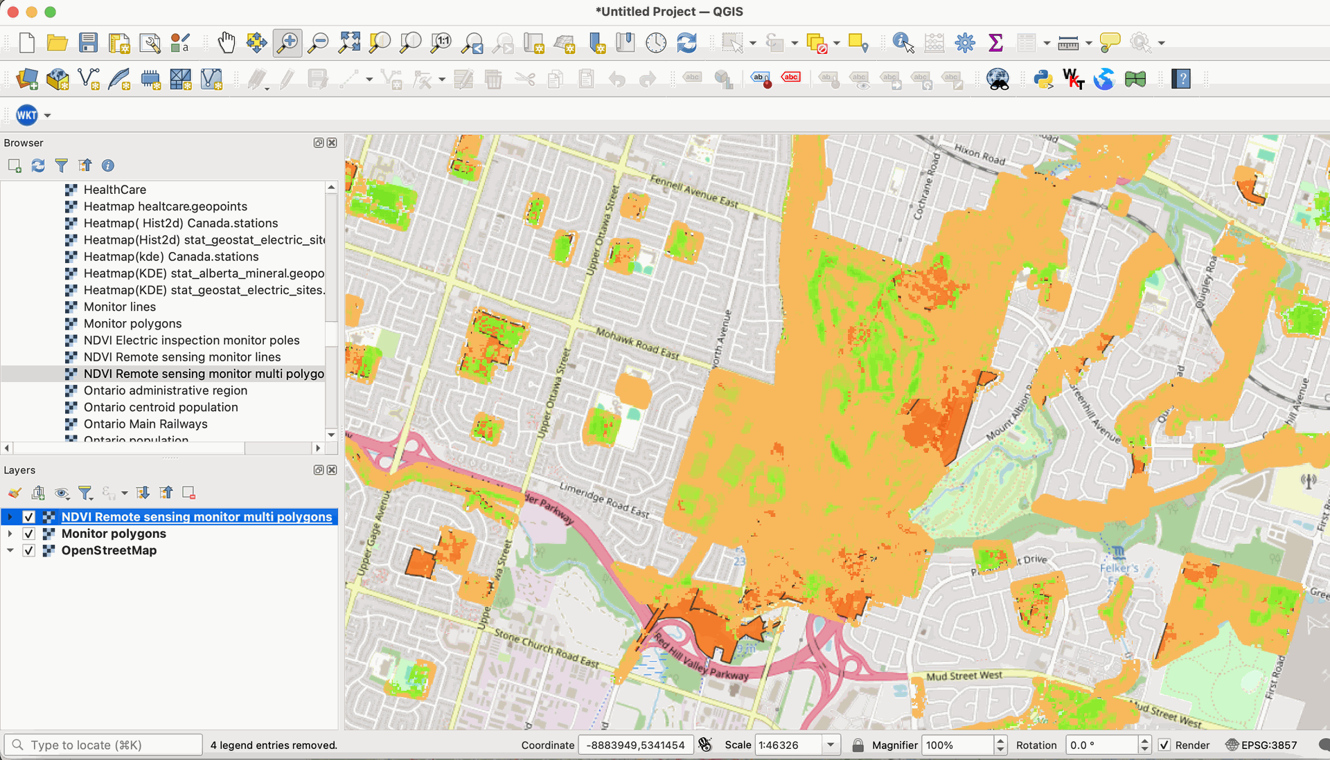
With our WMS Service module you can share your spatial information in many scenarios. Contact with us in order to test our Basic WMS demo service. In the picture below the service is consumed from the QGIS application.
Odoo geo-model import Wizards.
This Module is use to import the user's own cartography into the databases, linked to the data models defined in the system.
To allow the import of vector files into existed Models the module "Geoengine Import wizard" must be installed.
The user with "Geoengine Admin" role can import data from ESRI Shape files compressed as zip and text files in geojson format.
The wizard has three steps:
1. Upload the zipped Shape file and Select the target module.
The user can select their own cartography to use in their applications, as well as select the geo model that will be used to store their spatial data.

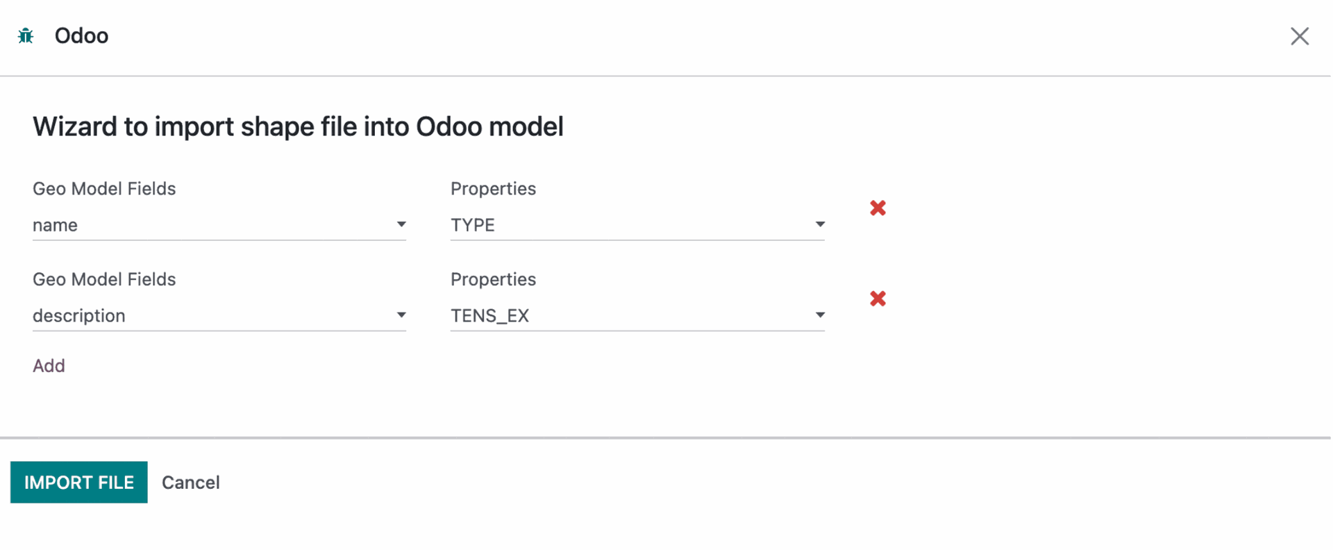
2. Map the source Shape properties and the Model fields to import the data.
When the user has already selected the shapefiles file and the system model, they must link the fields of their file with the corresponding one in the model.
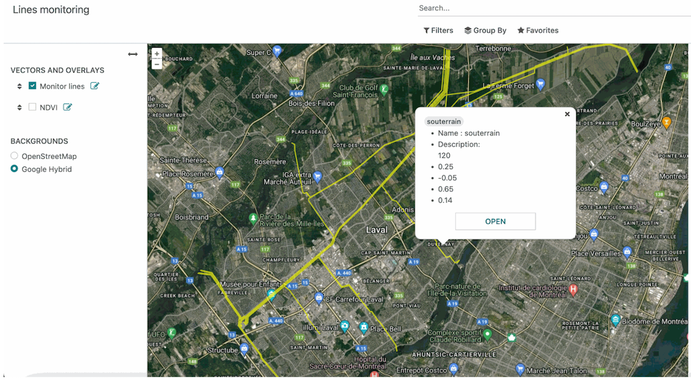
3. Once the data is imported a Geoengine View can be created to Visualize the Vector Data on the map.
In these module the tree test models has Geoengine views to view the data on the map.
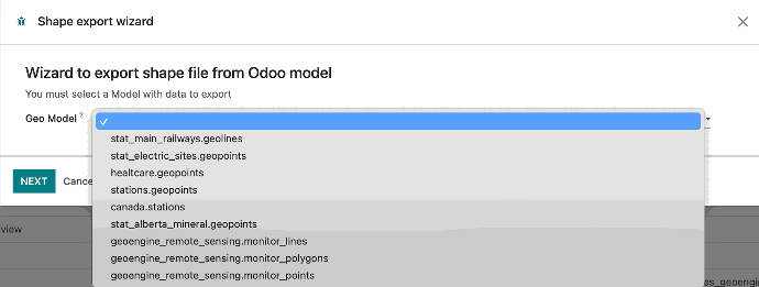
Odoo geo-model export Wizards
This Module is use to Export the user's spatial model from the databases in shapefile format.
The wizard has two steps:
1. Select the source module to export dat
The user can select their spatial model to export in shapefile format.
Cambiar imagen
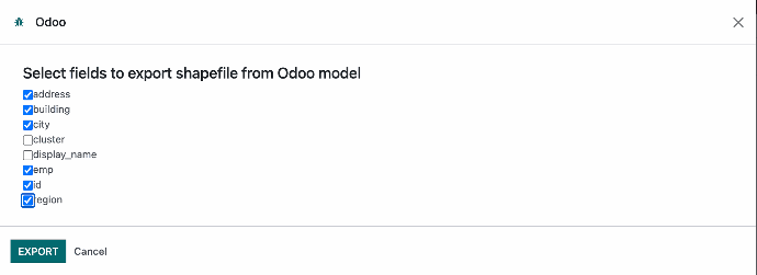
2. Select fields to be exported
The user must select the fields to be exported to the shapefile. the field names will be modified taking in consideration the shapefile convention to naming fields. All components will be downloaded as a single compressed zip file with the selected model as name.
